


VTOPO Cyclo Alpes de Haute-Provence
- In stock, ready to ship
- Papier écologique, label Imprim’Vert
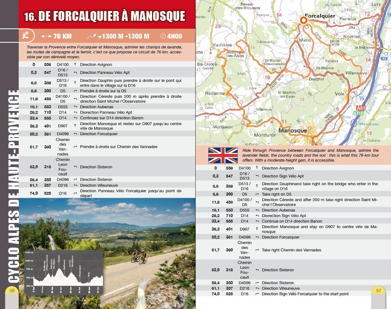
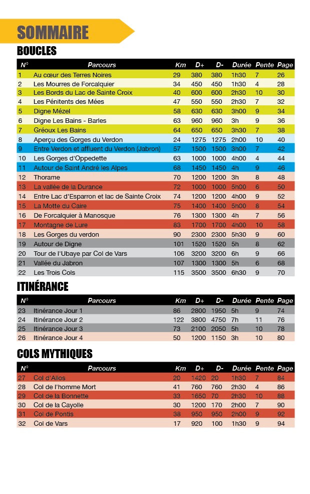
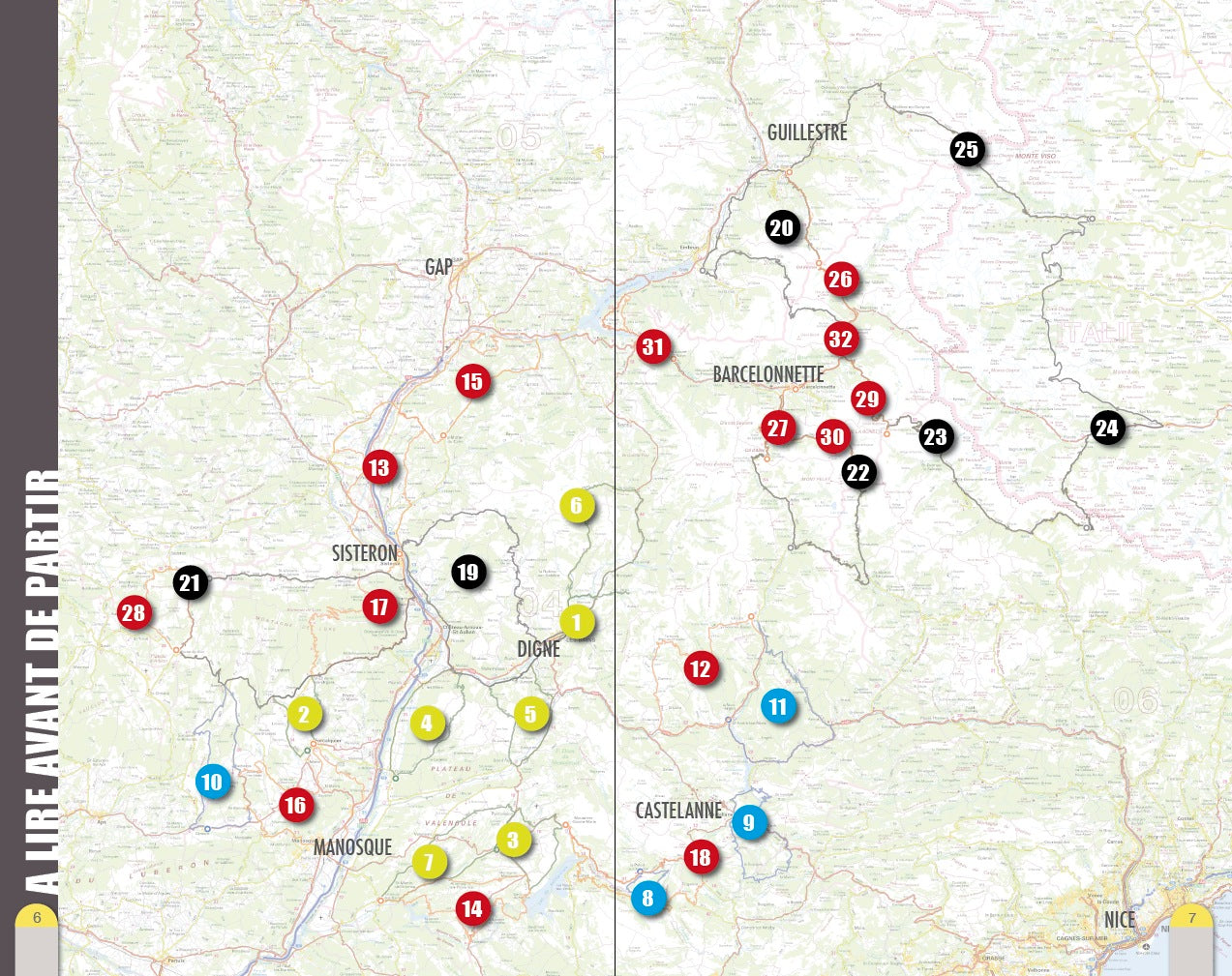
The Alpes de Haute-Provence, what a wonderful playground for cycling enthusiasts! This topo is an invitation to discover this department for all, whatever their level of practice, between plain and mountain. For each route, a short summary sets the tone of the hike, then a map and a description make it easy to follow the route. The 32 courses are classified according to a rating ranging from green to black. Exclusive and unique, a beautiful 4-day roaming between France and Italy. Good road !