When I started mountain biking, I lived in Salon-de-Provence at the time. I had two playgrounds, one near Arons and Vernègues (which I will show you one day), and another towards the Etang de Berre and Saint-Chamas. In both cases, I left home by bike, the trips quickly covered 30 to 40 km. At the time, I was riding a steel hardtail, I had as much fun mountain biking as I do now. I have always had a weakness for the playground which extends to the east of the Etang de Berre. It was my friend Fred Lopez who introduced me to a good part of it, particularly that around Saint-Chamas and Miramas-le-Vieux. Then by walking the hills many times, I was able to discover many little gem trails!
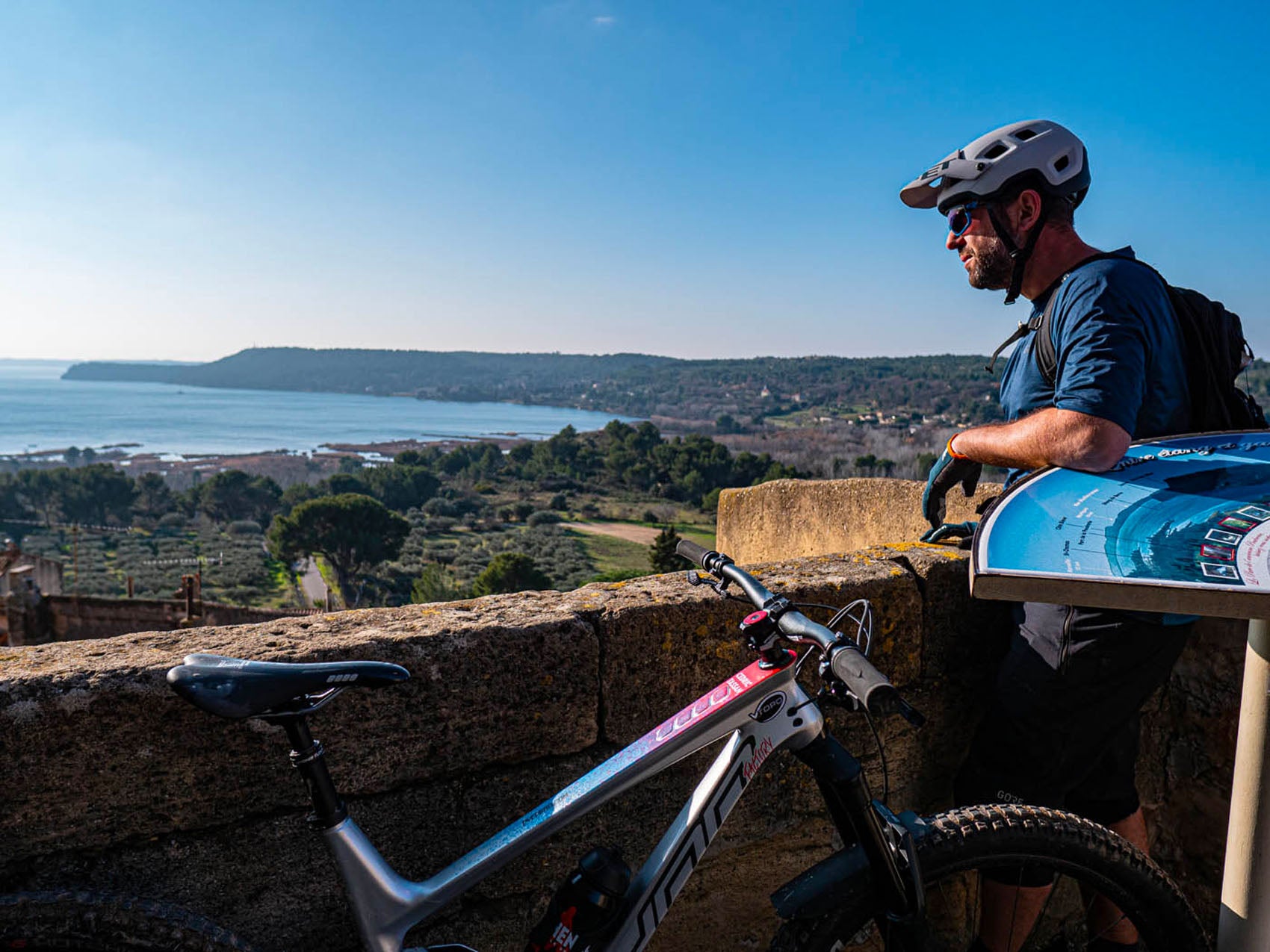
The playing field is rolling, fun, the difference in altitude is not very significant. But that in no way diminishes the interest in the sector. Because you can come here with all types of mountain bikes, from XC to enduro. For my part, I ride a Kern EN from Sunn, it's more of a big bike in 29" and 160 mm. But as it is rather lively, it behaves wonderfully on these playful trails. I start my route in Cornillon-Confoux, it is a pretty village which offers a distant but very pretty view of the Etang de Berre. Its yellow stones, marbled with encrusted shells, are characteristic of the local villages. We are talking here about Rognes stone, named after a village in Bouches-du-Rhône. From here extends a vast plateau of several thousand hectares which runs from Grans to the Etang de Berre.
It's a gruyere with paths, a real labyrinth where you can get lost very easily. The paths wind around pine trees and olive trees, crossing old stone walls and magnificent limestone slabs. Small valleys offer very fun descents. Furthermore, in the Cornillon area, a few years ago, a local initiative with official tracks saw the light of day (see more details in the associated insert).
I continue my route towards the pond. I try to go back into my memories to find the best trails, it's not easy because the options are so numerous. Further on, I reach the north bank of the pond, climb and gain height. The view opens to the south, the winter sun is not very high and shimmers on the flat surface of the water. I follow a pretty channel along a small cliff, the path is fun, I come across a few hikers who like me are enjoying this beautiful morning light. I know that in this way I could go as far as Istres but to avoid embarking on an endless outing, I turn around and take another dirt path in the area. I head towards Miramas-le-Vieux.
This pretty village, undoubtedly one of the most beautiful (and most famous) in the area, is perched on a rocky hill. During the high season, it is stormed by locals and tourists. Here we come to eat ice cream at the top of the village with breathtaking views. One of the local artisans offers the “Tendre passion”, a cup with 14 different sorbets! In the middle of January, everything is closed and I calmly climb the cobbled streets of the village. The architecture is magnificent, the stones are superb, I wander through alleys smaller than each other. I exit from the south of the village, a magnificent gate invites you to descend towards the Etang de Berre. Quickly, I arrive at Saint-Chamas.
Once at the entrance to the village, I find my bearings, follow the aqueduct and enter the hill. The path goes up and offers a superb view of the pond. The light has already changed, the colors are tinted. I cross an old stone quarry which must have been used to build certain buildings in the village. Some passages provide beautiful trajectories for mountain biking. Just after is the highlight of the show and the view overlooking the heart of Saint-Chamas: the Horloge aqueduct. 62 m long and 23 m high, it connects the 2 hills of the village and allows water to pass through and be transported to agricultural land. It was built from 1868. What a view of the village roofs and the port. I carefully descend the first flight of stairs then the second steeper one which leads to the entrance to the bridge.
In 2012, the aqueduct was made safe. Before, the water that flowed in the center of the bridge was not protected and the passage on either side was not very wide, one could easily fall into the canal. Now a grid covers the danger. After crossing the aqueduct, I continue my walk in the village, passing the troglodyte houses which enjoy a fantastic view, due west, over the pond. I continue in a row on the next hill and its chapel then the last one before heading towards the Petite Camargue.
It is an exceptional nature reserve, similar to the landscape found in the Camargue: pond, reeds, large shell beaches, bird watching, swamp. Even if this place is not of interest in terms of trails for mountain biking, I love coming there to feel this peaceful and wild atmosphere. I like to imagine what the Etang de Berre might have been like before the arrival of industries, it must have looked like this Petite Camargue.
In addition to industrial pollution, man has disrupted the aquatic ecosystem of the pond. Not far from there, at the power station, there is the fresh water of the EDF canal which flows into the salt water. The waters of the Verdon and the Durance are discharged here in large quantities. In 2004, Europe strongly condemned France for these discharges which did not respect the commitments made for the protection of the Mediterranean (Athens Protocol, 1980, Barcelona Convention, 1976). The Court of Justice of the European Union recognizes that these discharges represent massive pollution for the Etang de Berre and requires the French State to take corrective measures. Even if the releases have since decreased, they still are 17 years later...
After making my way through the reeds via a small path, I leave this magnificent wetland via a path along the coast. I return towards Saint-Chamas via a few side roads then cross the Flavien bridge. This Roman bridge, built 2000 years ago and placed on the Roman road linking Marseille to Arles, as an extension of the Via Aurelia, spans the Touloubre. This construction is magnificently preserved, I ride in the traces left by the tanks all these years, the furrows have deeply marked the limestone.
I climb the plateau again, wander through the woods then find an old path that I liked to take at the time. The descent is short but very technical. And yet I was thinking with a mountain bike that was more like a road bike! Not sure I could do it again with such a machine these days! I end my day of cycling by climbing towards Cornillon, the sun is already very low. It floods the ocher stones of the village with a warm light. The temperature drops quickly, I quickly return to the warmth of my van.
INSERT: DAVALDO Cornillon Freeride (DCF)
In Cornillon-Confoux, communal land has been made available to the DCF for the creation of mountain bike trails in the area. This local initiative is a good example of how mountain biking can work hand in hand with public stakeholders. Here, a handful of enthusiasts shape and maintain this magnificent valley while relying on ancestral and agricultural shaping. Here, to come and ride, you must join the DCF. The contribution is modest, 20 euros per year. The idea, beyond being able to ride, is also to lend a hand to work and maintain the tracks. We can only advise you to contact this association.
Contact via their Facebook page.
GO :
Departure from the village of Cornillon-Confoux, located west of Salon-de-Provence
Or sleep :
We recommend staying in a B&B in the area. The buildings and the countryside are so beautiful!
WHERE TO EAT :
In high season, obligatory stop at Miramas-le-Vieux to eat a good ice cream.
HAVE TO DO :
Taking the time to discover the local heritage and the pretty villages is the advantage of cycling! Bird watching at the Petite Camargue is highly recommended.
COURSE :
The Itinerary can be found here via VTOPO PREMIUM . or in the VTOPO Bouches-du-Rhône latest edition.



Leave a comment